|
|
|
Figure 1.
Middle Danger Area of
Potomac River
|
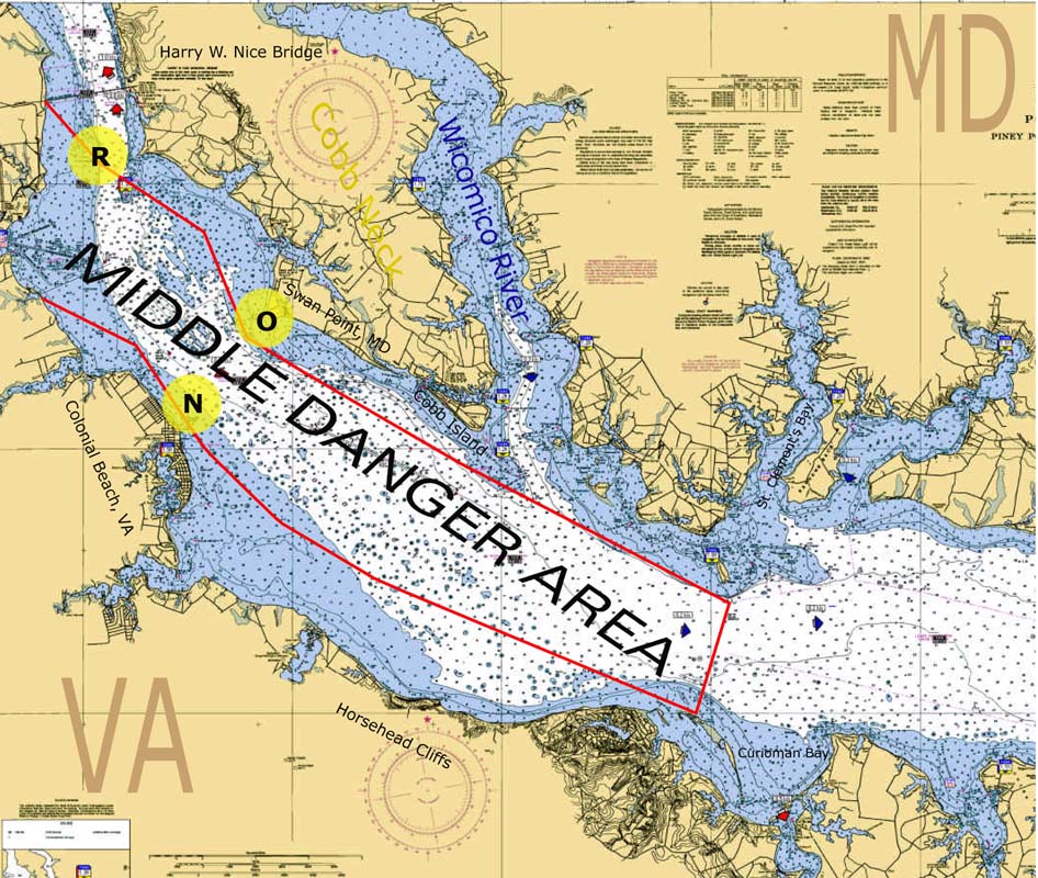
Figure 1 shows the Middle Danger Area of the Potomac River. The Naval Surface Warfare Center, Dahlgren Site (NSWCDL), Dahlgren, Virginia furnishes this chart, in the interest of the safety of watercraft traffic on the Potomac River. It does not apply to the aircraft flying over the area.
The Potomac River Middle Danger Area is part of the large danger area described in the U.S. Coastal Pilot 3, Atlantic Coast, Sandy Hook to Cape Henry. Entry into this area is hazardous to watercraft when guns and other ordnance items are being fired or other testing is being conducted by the NSWCDL in connection with the development of weapons for national defense.
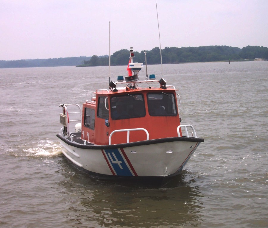
In order to assure that no watercraft are endangered by such testing, NSWCDL stations range control boats (international orange superstructure over white hull) in the proximity of areas rendered hazardous by the test operations. Figure 2 shows a range control boat. It is the responsibility of these boats to ensure that no watercraft are endangered by the test operation. Normally, these boats are located near Lower Cedar Point (Buoy "R", near 301 bridge), near Swan Point, Maryland (Buoy "O"), off shore at Colonial Beach, Virginia. (Buoy "N"), and at the mouth of Upper Machodoc Creek. These buoys are depicted on the Middle Danger Area map.
|
|
|
Figure 2.
Range Boat
|
When range control boats are flying a red flag, watercraft must not enter any portion of the danger area or operate anywhere close to the danger area without having obtained permission from the nearest range control boat. A siren sounded at a watercraft from a range control boat is a signal to come alongside for instructions as to how to proceed and information on areas that must be avoided.
A red flag will be flying at the NSWCDL Yardcraft piers during times that test operations are being conducted in the Potomac River. All watercraft that desire to proceed in or out of Upper Machodoc Creek during test operati0ons will be provided specific instructions for transit. Normally, use of the back channel (along a line from Buoy "P" to NSWCDL Yardcraft main pier) will be permitted.
Firing schedules are arranged to cause minimum inconvenience to river traffic and generally the range is not closed for long periods of time. Normally, test operations are conducted between the hours of 8:00 AM and 5:00 PM daily, except weekends and national holidays. Infrequently, the range is used during other hours and/or at night in order to take advantage of favorable light or atmospheric conditions or due to emergency situations.
When testing is in progress, entry into any part of the danger area without specific clearance by proper authority is prohibited by regulations promulgated by the Corps of Engineers, U.S. Army, pursuant to the authority of Sections 1 and 3, Title 33, U.S. Code. The danger areas are described in the U.S. Coastal Pilot 3, Atlantic Coast, Sandy Hook to Cape Henry. Although these regulations are enforceable, NSWCDL desires to cooperate with, and assist, all watercraft operating in the Potomac River danger areas.
Dahlgren Range Control monitors marine ship-to-shore channels 16 and 14 and citizens band channel 5. Please direct questions and request for information to Naval Support Activity South Potomac Public Affairs Office, (540) 653-8153 or NSWC Dahlgren Public Affairs Office, (540) 653-8152.